Gee. I wish I had a place to hang it. I've got so-o-o many real maps that I can't hang them. I am planning to hang a very colorful "silk" escape map that I just got.
Let me show you one of several maps I recently obtained. These are field maps used by infantry and artillery commanders that have the grids and topography. BUT this one is made from Aerial Photographs. It is 1:12,500 scale, which is the lowest scale that they made and it is marked with the same identification & coordinates as the regular grid maps. The largest scale would be identified with a Number such as 87. Then these would be divided into quadrants at 1:50,000 scale with a Roman numeral identifier. Then they were sub-divided into 1:25,000 scale maps and identified with 2-letter compass identifiers---so we are now at 87-II NW. This one is even further divided into the smallest scale and have a lower case letter in ().
This one is a map of southern half of Bologna and identified in upper RH corner as 87-II NW (a) , and the scale at the top margin. This is, of course, only a small corner of the map. The grid coordinates for the middle letter "O" in Bologna would be 872-485.
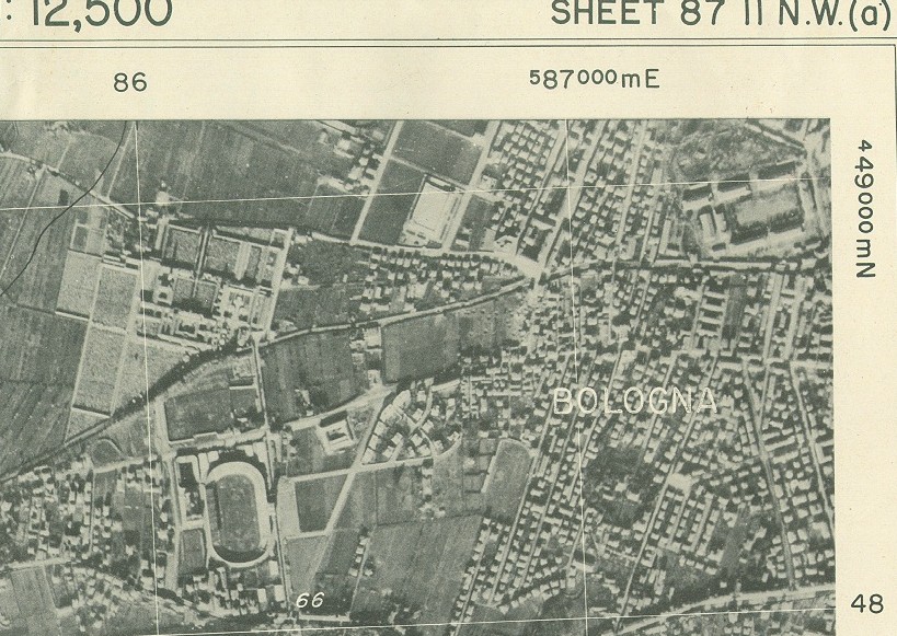
Scale: 1:12,500 (1 inch = 694 yds)
Size: 22.5 X 20 inch. (Each grid square is about 3-1/4 inch per side)
Dated: February, March April, 1945.
Town, Mtn & River names and Grids and topograghy are overlayed on the photo in black & white.
Further down on this sheet, you can clearly see a cluster of bomb craters where Hiway 64 crosses the river.
Cool, eh?
Steve